Introduction
This tutorial will guide you on using the Tabaqat Satellite Data Downloader Tool to download sentinel satellite imagery for any area in Saudi Arabia in a specified time range. We'll show you how to edit tool configuration files with the required parameters and how to run the tool to get the data. Additionally, we'll demonstrate how to import and preview this data in GIS software like ArcGIS Pro for further analysis and visualization.
Technical Guide
To use the tool, You need to Sign in to tabaqat to get software key to install tabaqat GeoApps on your device by following steps of this Guide : https://tabaqat-wagtail.tabaqat.net/en/resources/blogs/step-by-step-guide-to-accessing-tabaqat-geoapps-unlocking-geospatial-tools-for-enhanced-analysis/
1. Open Command Prompt to run the tool.
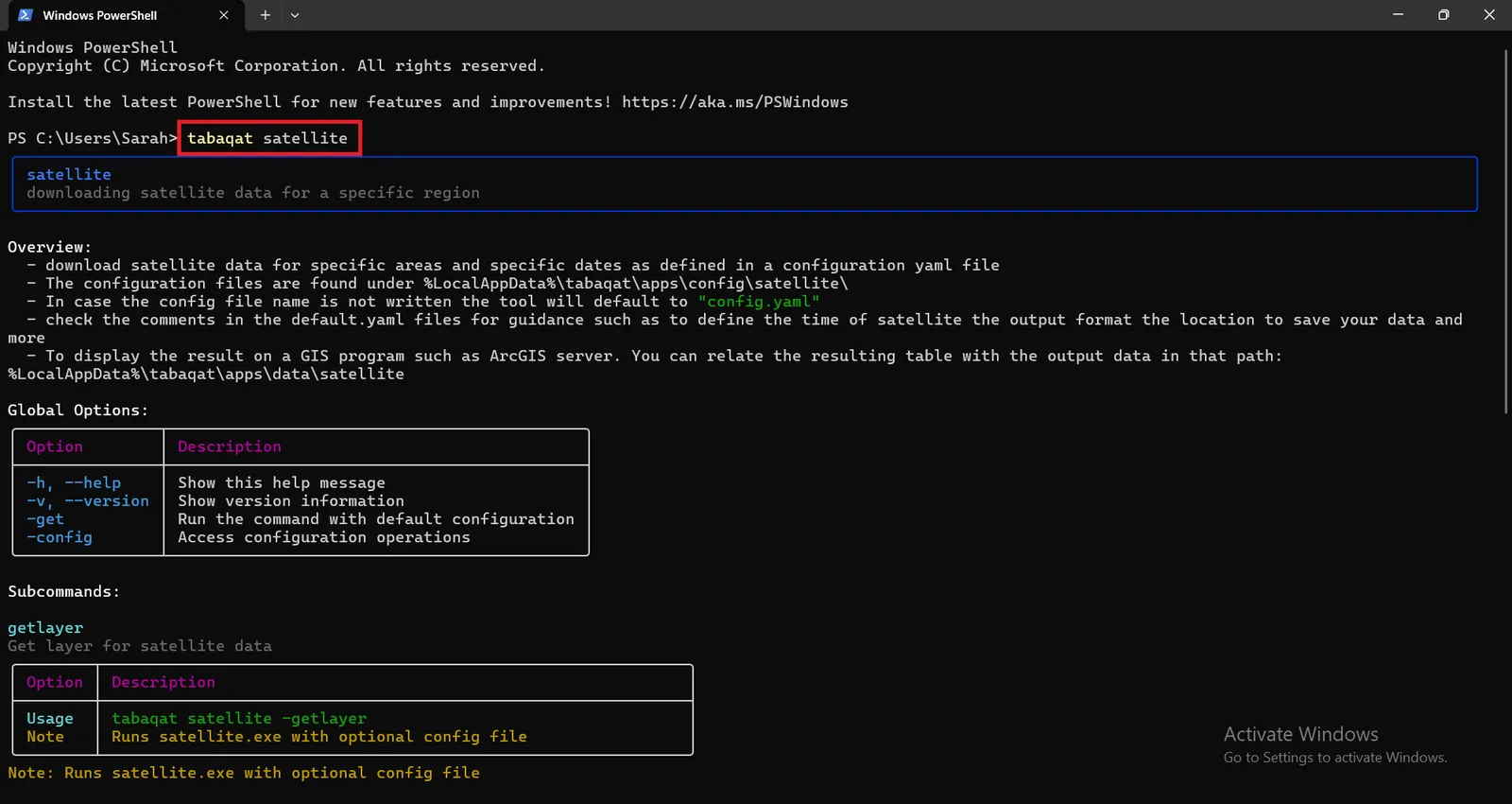
2. Type tabaqat satellite in the command prompt and run it.
Running tabaqat satellite command provides an overview of the tool's usage and available global command options. These options include:
- -get: This option is used to retrieve satellite data.
- -h: Displays the help message for the tool, listing available commands and options.
- -v or --version: Shows the current version of the tool.
- -config: Provides access to configuration operations.
Additionally, the command output includes all available subcommands, such as:
- getlayer: Used for retrieving specific layers of sentinel satellite data.
- config: For managing configurations.
- config list: Lists all available configurations.
- config list_aoi: Lists configurations for areas of interest (AOI).
The output will also include examples of basic usage, how to list configurations, and how to view detailed configuration information.
Configuring And Running The Tool With The Default Parameters To Get Sentinel Data
- To view the default configuration parameters in the default_config file, located at the following path: %\AppData\Local\tabaqat\apps\config\tools\satellite, you can execute the following command in the Command Prompt: tabaqat satellite -config -describe config.yaml
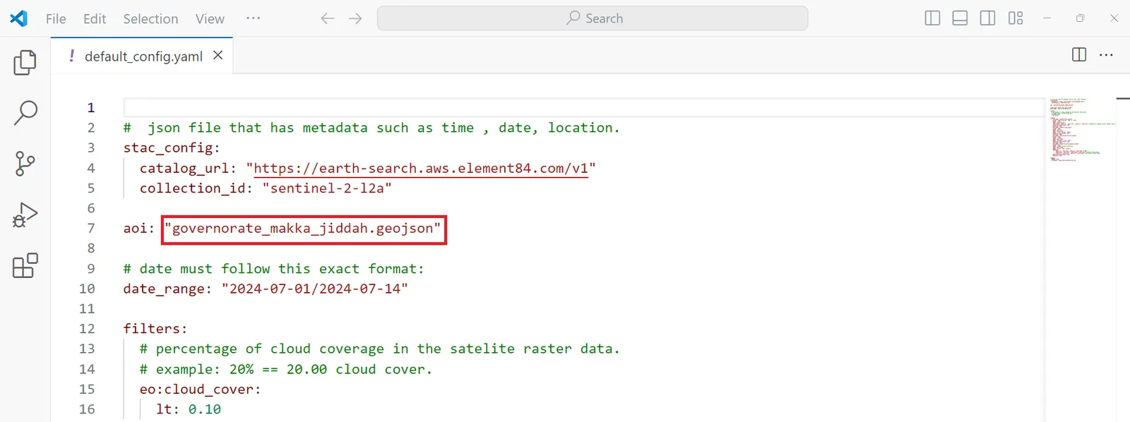
- You can edit the default config.yaml file to specify the desired area of interest (AOI) and the time range for the target satellite data. Adjusting these parameters will allow you to tailor the satellite data retrieval to your specific requirements.
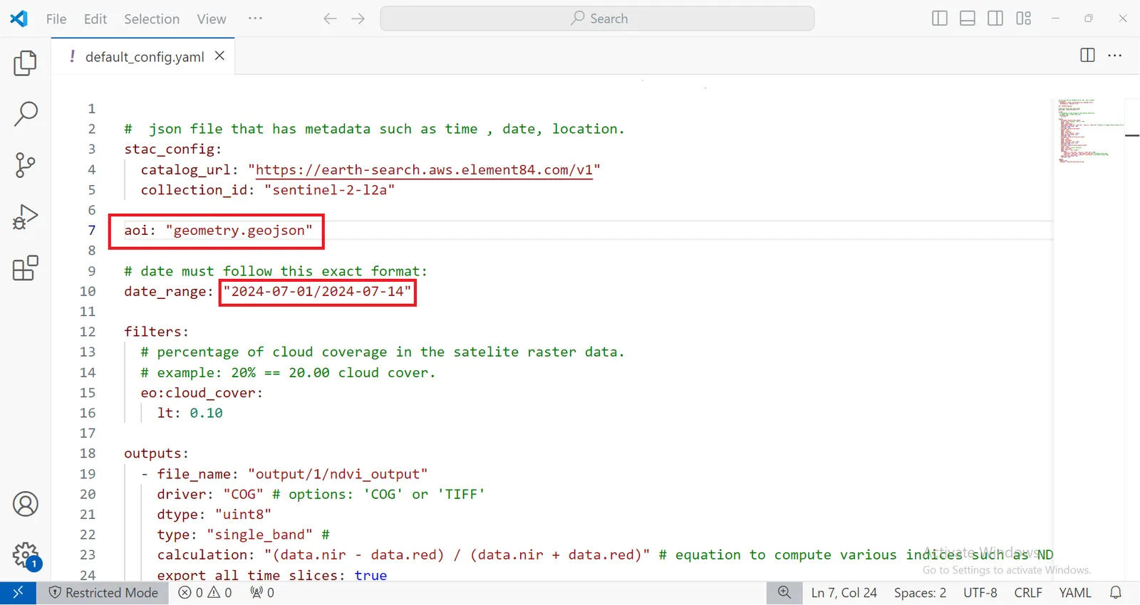
- To run the tool using the default parameters, including the default area of interest (AOI) defined in the geometry.geojson file located in Madina city, and the default time range from 2024-07-01 to 2024-07-14 to retrieve sentinel-2-l2a satellite data from https://earth-search.aws.element84.com/v1, simply execute the following command in the Command Prompt: tabaqat satellite -get
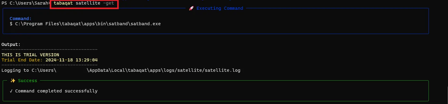
- Once the Sentinel satellite data retrieval process is complete, all the output data will be located in the following directory: %\AppData\Local\tabaqat\apps\data\satellite\output
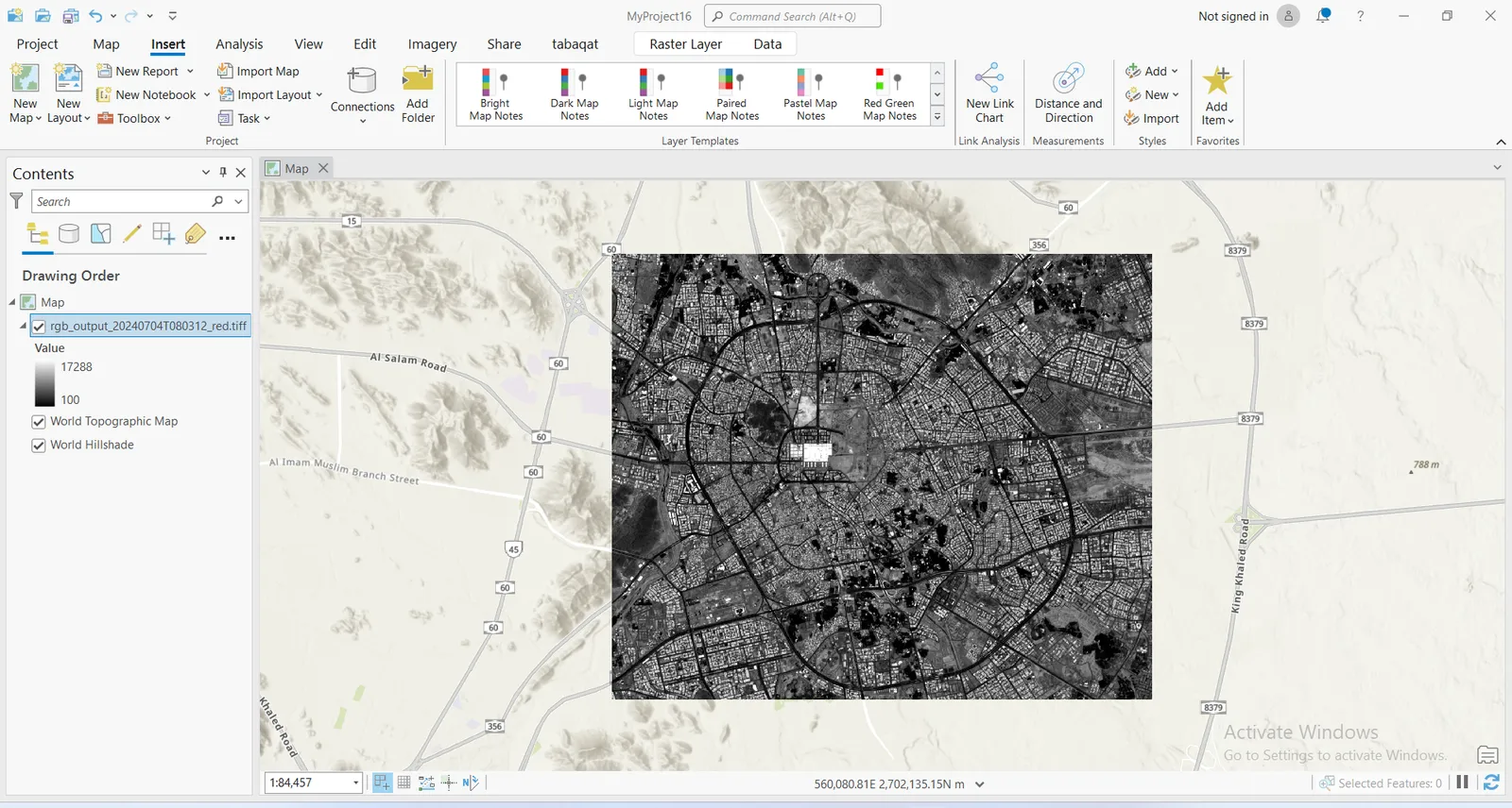
Visualizing Output Sentinel Data In ArcGIS Pro
- After retrieving the Sentinel satellite data, you can investigate and analyze it using GIS software like ArcGIS Pro. To do so:
1. Open ArcGIS Pro.
2. Add the output data from the following directory: %\AppData\Local\tabaqat\apps\data\satellite\output
3. Once the data is loaded, you can visualize it and perform various geospatial analysis, such as change detection, land cover classification, or any other analysis relevant to your project.
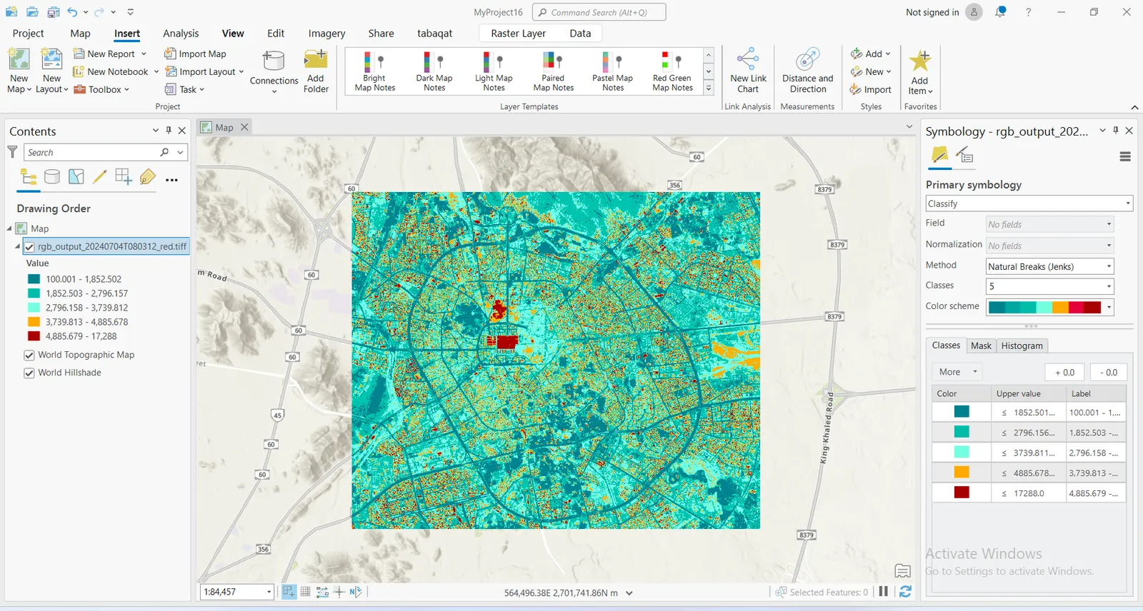
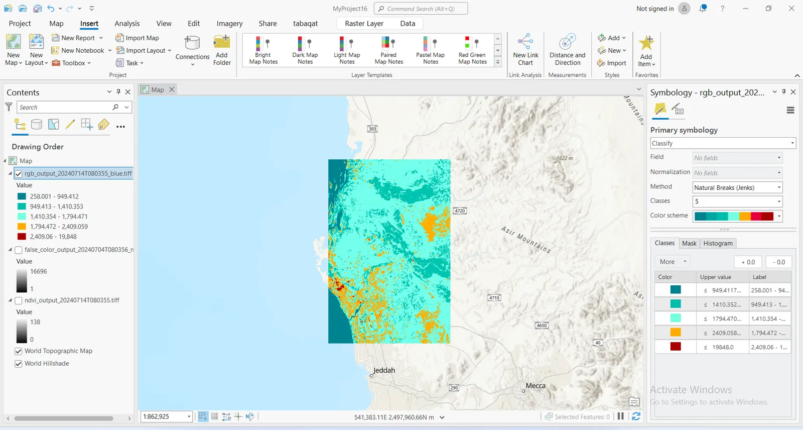
4. You can also style the output satellite image by applying a color scheme through classification, grouping the data into a specified number of classes (e.g., 5) using a classification method, such as "Natural Breaks".
Getting Sentinel Data for Different AOI
- Also, You can also choose a different Area of Interest (AOI) by selecting one from the following directory: %\AppData\Local\tabaqat\apps\config\aoi
- Alternatively, you can list available AOIs by typing the following command in the Command Prompt and running it: tabaqat satellite config list_aoi
- After selecting your desired AOI, edit the default config.yaml file to specify the new AOI, for example: aoi: name_of_new_aoi.geojson (like : governorate_makka_jiddah.geojson) and save the edits
- This will configure the tool to retrieve sentinel satellite data for the newly selected AOI.
- After running the command executed before to get the satellite data for the desired AOI "tabaqat satellite -get", Visualize the output data in ArcGIS Pro.
Conclusion
By utilizing the Tabaqat Satellite Data Downloader Tool, you have efficiently retrieved and visualized satellite data for your area of interest within a specified time frame. This process not only enhances your ability to access and analyze geospatial data but also provides a foundation for further analysis and decision-making in various GIS applications. With these steps, you are now equipped to leverage satellite imagery for a wide range of projects, from environmental monitoring to urban planning and beyond.