Tabaqat GeoApps offers a suite of applications designed to facilitate the collection and management of geospatial and business data.
- ArcGIS Server Extractor: Download ArcGIS Server layer data directly to your local system.
- CSV Geocoder: Geocode CSV files based on area names for seamless integration into GIS software.
- Satellite Downloader: Automate the retrieval of Sentinel-2 data, apply cloud filtering, and calculate vegetation indices.
- Weather Live Data: Access regularly updated weather data in real time.
- Aircraft Live Data: Access live, regularly updated data on aircraft activity.
- Earthquakes Live Data: Access live, regularly updated earthquake records.
- Overture Maps: Obtain the latest base map data for your specific area of interest.
Tabaqat GeoApps empowers users to:
- Harvest thousands of business intelligence and GIS datasets.
- Collect live data from various external sources.
- Access and retrieve authoritative data from all Saudi government organizations using ArcGIS Server.
- Obtain government open data from sources like the SDAIA Open Data Catalog and KAPSARC.
- Automate the retrieval of Sentinel-2 satellite data, apply cloud filtering, and compute vegetation indices.
This comprehensive toolkit streamlines data acquisition and analysis, enhancing geospatial and business intelligence capabilities.
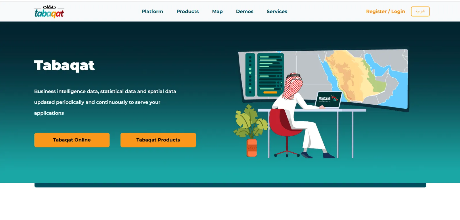
To start leveraging the power of Tabaqat GeoApps for geospatial and business intelligence, you’ll need to complete a quick signup process. Follow these steps to create your account and gain access to a range of its powerful tools
1. First you need to Sign up to https://tabaqat.net/.
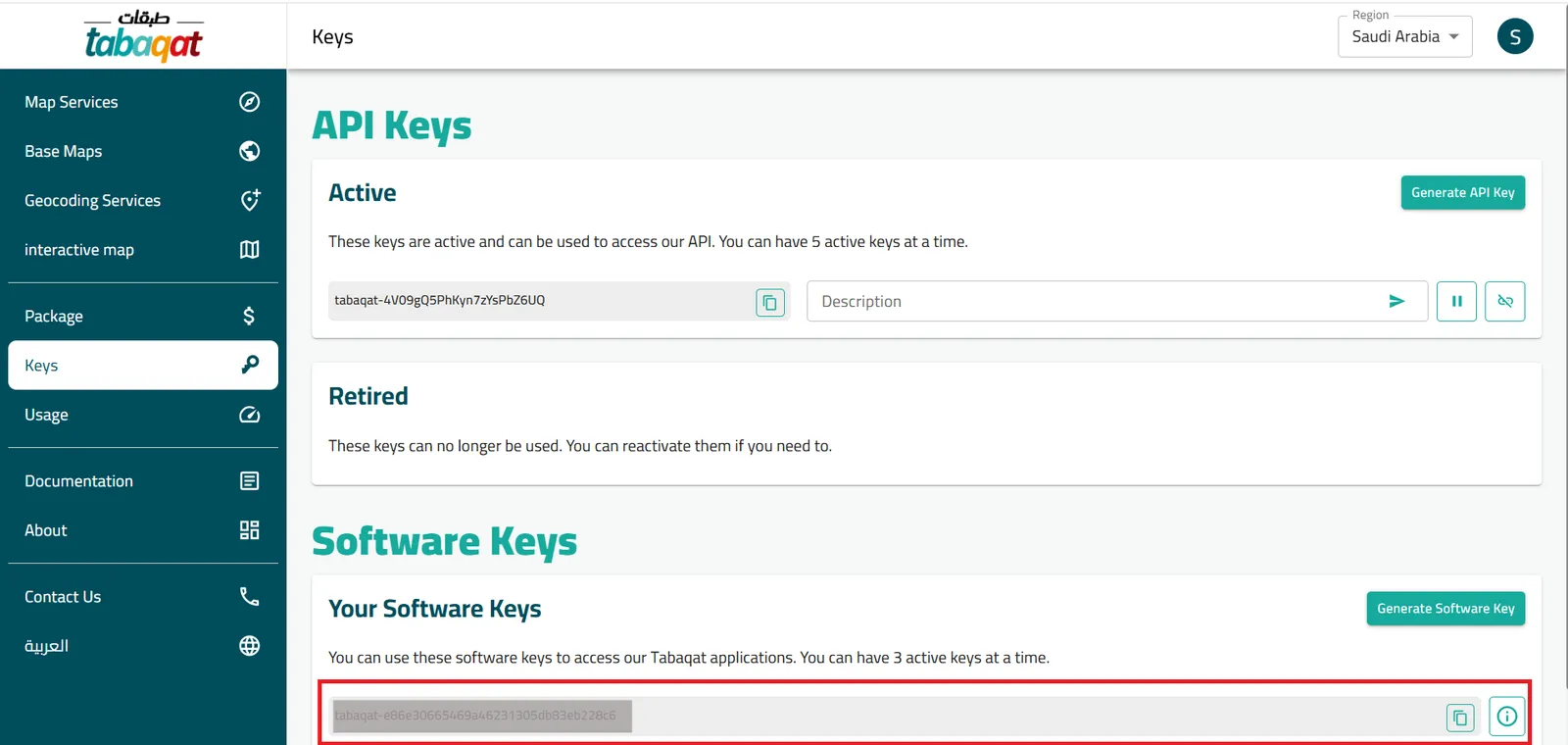
2. To get software key to install Tabaqat GeoApps on your device, navigate to https://platform.tabaqat.net/keys.
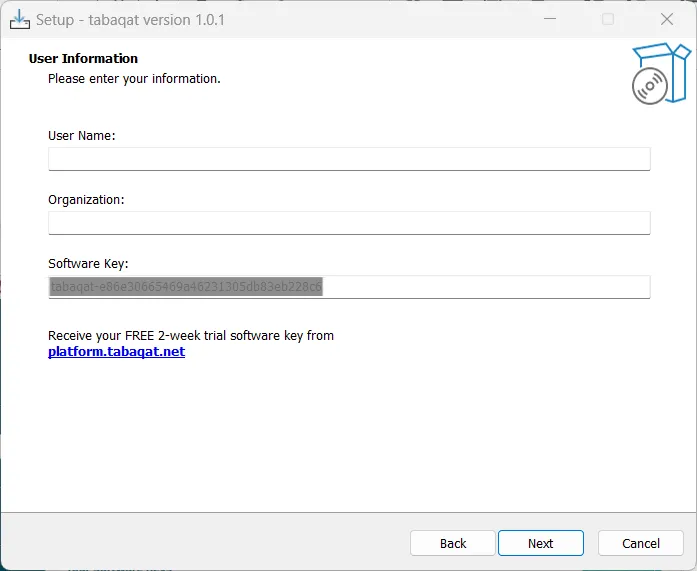
3. Paste your software key and type your user name to continue the installation process.
Congratulations on completing the signup process! You’re now ready to explore the full potential of Tabaqat GeoApps. With your new access, you can efficiently gather, manage, and analyze geospatial and business intelligence data using our suite of powerful tools. Dive into real-time data, automate satellite imagery processing, and integrate authoritative datasets seamlessly.